Geograph’s Geodetic Rock Star Barry Hunter attended the State of the Map conference at the weekend, and noticed something interesting in Ed Parson’s presentation…
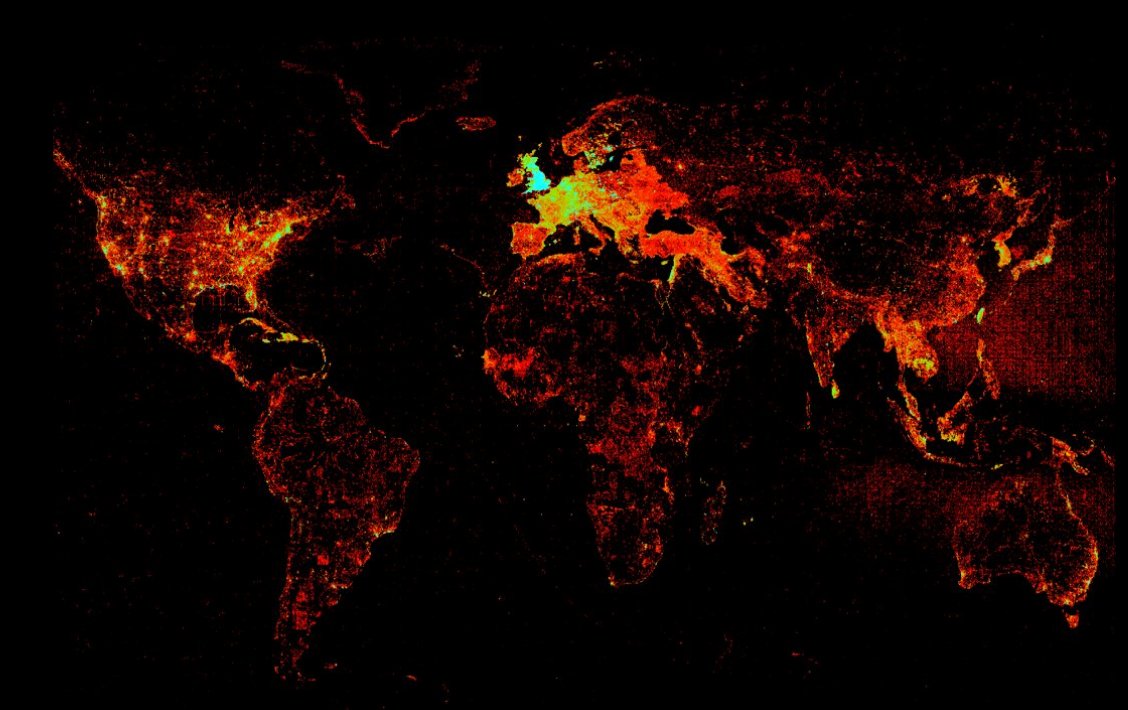
That is a map of worldwide KML and GeoRSS feeds indexed by Google. But look, the British Isles are on fire! Could this be Geograph’s infamous warm glow at work?
 Pictured right is Geograph’s current coverage map (click for an impressive 1km per pixel version). Each red dot is a 1km grid square where we have at least one photograph.
It certainly looks like there is some correlation between those maps, and shows that our 500,000+ web pages are being well indexed by Google.
Onwards and upwards!
Pingback: nearby.org.uk blog » Blog Archive » The British Isles is burning!
Pingback: nearby.org.uk blog » Blog Archive » Geograph: Watching the Fire build