Category Archives: Geodata

Fire Eagle Invites – Want One?

I have a couple of spare invites for Yahoo’s new location service Fire Eagle, which had a limited beta launch today. Leave a comment if you want one.

I had a quick play earlier and as TechCrunch noted, it’s a little light on features right now! If nothing else, the current beta gives a glimpse of how they will manage the privacy issues surrounding a “always on” awareness of your location.

I might see what I can hack together to use it while doing the Trailwalker Challenge later this year!
Geohash PHP class

geohash.org popped up recently with a method of generating short hash codes for geographical locations. The codes have some interesting properties and the algorithm is documented on wikipedia.

I recently started doing a Project Euler problem a day as a fun diversion. I found the geohash algorithm intriguing, so it became my “Euler problem” for the day!

Having done it, I’m not sure I’ll find a use for it myself, but if anyone else finds it handy, do let me know!

Download it here.

The Geograph Warm Glow – Now Red Hot!

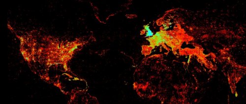
Geograph’s Geodetic Rock Star Barry Hunter attended the State of the Map conference at the weekend, and noticed something interesting in Ed Parson’s presentation

That is a map of worldwide KML and GeoRSS feeds indexed by Google. But look, the British Isles are on fire! Could this be Geograph’s infamous warm glow at work?

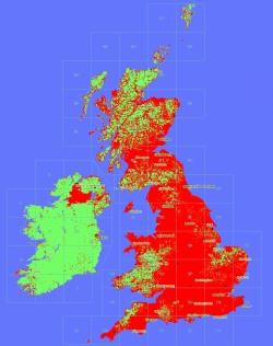
Pictured right is Geograph’s current coverage map (click for an impressive 1km per pixel version). Each red dot is a 1km grid square where we have at least one photograph.

It certainly looks like there is some correlation between those maps, and shows that our 500,000+ web pages are being well indexed by Google.

Onwards and upwards!