Monthly Archives: July 2007

500,000th Geograph Photo!

Yesterday Geograph got its 500,000th photo – the archive now contains over half a million, freely reusable, geographical and geolocated images!

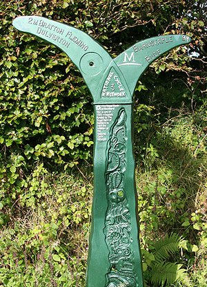
Rather serendipitously, the image that tipped the balance was of a milepost marker, taken by Martin Bodman.

Remember, all the photos are licenced with a Creative Commons by-sa-2.0 licence, making an astonishly useful resource which we hope will become a lasting archive.

Here’s to the next milestone – one million images! We should hit that sometime before December 2008…

Flood images on Geograph

Some awesome images popping up on geograph covering the floods (for example, see thread, registration required). A particular sequence taken by Jonathan Billinger shows how swiftly things can change for the worse…

5:12pm 20th July 2007, 5:12pm – Evesham Waterside hotel. The river Avon is over the road…
6:28pm 20th July 2007, 6:28pm – a little over an hour later, and the road is flooded but a brave driver might just make it!.
8:03pm 20th July 2007, 8:03pm – after 3 hours though, the road is impassable and the hotel is starting to flood. How bad can it get you wonder?
5:51am 21st July 2007, 5:51am – you wake up early the next morning and this sight greets you! The water is still rising too…
1:51pm 21st July 2007, 1:51pm – less than 24 hours have passed and the water level peaks.
7:04am 22nd July 2007, 7:04am – the next morning, and the waters are starting to recede.

There’s always an inescapable voyeurism with natural disasters like this, and while I feel for those affected by the floods, you can’t help but see images like this and say “wow!”

The Geograph Warm Glow – Now Red Hot!

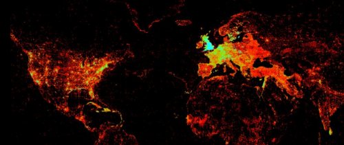
Geograph’s Geodetic Rock Star Barry Hunter attended the State of the Map conference at the weekend, and noticed something interesting in Ed Parson’s presentation

That is a map of worldwide KML and GeoRSS feeds indexed by Google. But look, the British Isles are on fire! Could this be Geograph’s infamous warm glow at work?

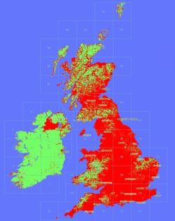
Pictured right is Geograph’s current coverage map (click for an impressive 1km per pixel version). Each red dot is a 1km grid square where we have at least one photograph.

It certainly looks like there is some correlation between those maps, and shows that our 500,000+ web pages are being well indexed by Google.

Onwards and upwards!